
How to get to Karaman? Where is Karaman, in which region? Places to visit, food and districts in Karaman
Karaman is an important center for trade, culture, and art. The city and its surrounding area have been inhabited since 8000 BC and are home to underground cities, caves, and religious centers. Our citizens are asking "How do I get to Karaman?" Here are the places to visit,...
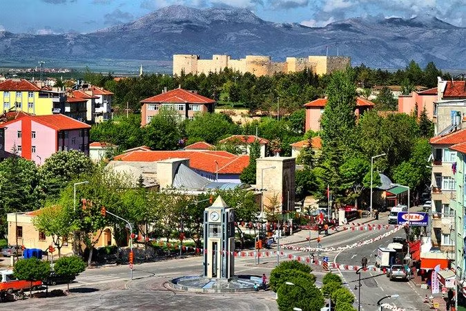
Karaman is an important center for trade, culture, and art. The city and its surrounding area have been inhabited since 8000 BC and are home to underground cities, caves, and religious centers. Our citizens are asking "How do I get to Karaman?" Here are the places to visit, famous dishes, and districts in Karaman.Karaman is a city in Turkey where Turkish was declared the official language by Karamanoglu Mehmet Bey. WHERE IS KARAMAN, IN WHICH REGION?Karaman is located in the Central Anatolia Region of Turkey. It is bordered by the provinces of Konya to the west and north, Mersin to the south, and Antalya to the southwest. The province has an area of 8,678 km2. There are 29 people per km2 in the province. TRANSPORTATION TO KARAMANKaraman Otogar is located in the city center and can be reached on foot. It is located in the middle of three major cities, Mersin, Antalya and Konya, so there are direct flights from almost all of Anatolia. There is also a bus that leaves every hour from the bus station to all districts of Karaman.The bus journey from Istanbul to Karaman takes 13 hours, while the journey from Ankara to Karaman takes 6 hours. Those who want to come to Karaman by bus from Izmir have to 10 hours. Transportation to Karaman by TrainKaraman has its own central train station. The city can be reached by rail via the Toros Express, the Posta Express, and the Mavi Tren. Karaman can be reached from Istanbul-Pendik via Ankara. The journey from Ankara takes 45 TL, and from Adana the Toros Express can be used for the journey. The quickest and safest way to reach Karaman is by train. KARAMAN DISTRICTSThe population of Karaman is 254,919. 80.9% of this population lives in cities (as of 2020). The province has an area of 8,678 km2. There are 29 people per km2 in the province. (This number is 49 in the center.) The annual population growth rate in the province has been 0.65%. The highest and lowest population growth rates in the province are in the center (% 1.12) and Kazımkarabekir (-% 8.60), respectively. According to TUIK data, there are 6 districts, 11 municipalities, 133 neighborhoods and 158 villages in the center municipality together with the central district as of February 4, 2021. AyrancıBaşyaylaErmenekKazımkarabekirMerkezSarıvelilerKARAMAN PLATE: 70 PLACES TO GO IN KARAMANTaskale Granaries Hatuniye Madrasa Uncle Hurrem House Imaret Mosque Aktekke Mosque Zeyve Market Karaman Castle Manazan Cave Karaman Museum İncesu Cave Church with Fountain Tartan Mansion Madensehir Ruins Fisandon Church Mosque Ermenek Turquoise Dam New World Cave KARMAN DISHESCalla Dolaman Yemeği Çullama Töğmeken Bıldırcın Dolması Fırın Kebap Batırık Zeyve Kebabı
Henüz yorum yapılmamış. İlk yorumu siz yazın!